
Mauherslieve [Motharshliabh]
Good walks are even better shared.
Overview
Mauherslieve [Motharshliabh]
Mauherslieve, towering at a proud 628 meters, is a gem in the Galtee Mountains that beckons hikers with both its rugged beauty and rich cultural history. Known as Motharshliabh in Irish, its name translates to 'mountain of the moon,' which seems appropriate given the ethereal beauty of its summit views.
Geology
The mountain is predominantly composed of Old Red Sandstone, providing a remarkable backdrop of geological history. Old Red Sandstone is a sedimentary rock that formed in the Devonian period, so you’re essentially walking over millions of years of history! The landscape showcases the fascinating remnants of glacial activity, characterising the terrain with both charm and challenges.
Routes
There are several routes to take, but two of the most popular are the Mauherslieve Loop and the Ballyhoura Trail. Both offer a delightful combination of scenic beauty and manageable challenge.
- Mauherslieve Loop: This 8.5 km loop is a favourite. Starting from the base, it takes about 3 hours to complete and gives ample opportunity to pause and admire the breathtaking views unfolding around you.
- Ballyhoura Trail: If you're seeking a more leisurely stroll, the 7 km Ballyhoura trail is an excellent alternative, easily navigable in approximately 2.5 hours and perfect for families.
Summit Features
Upon reaching the summit, hikers are greeted by a modest cairn and a trig point – an ideal spot for that all-important summit selfie. You’ll want to capture the moment that confirms you’ve mastered this mitre of the mountain!
Terrain
Expect a mixed terrain of grassy slopes intertwined with rocky pathways. Parts of the trail can be boggy following rain, so sensible trousers and waterproof footwear are essential – we don’t want muddy socks chasing your ambitions, do we?
Views
From the top, panoramic views encapsulate the majesty of the Galtee Mountains and beyond. On a clear day, the sight of the Shannon Estuary can make your heart skip a beat. Early mornings in spring and autumn are particularly splendid times for the best views – and Instagram-worthy moments!
Hazards
While the trails are generally safe, be wary of loose rocks, especially if you're a bit of a klutz like some of us! Visibility can be a fickle friend if fog rolls in, so keeping a map or compass handy is wise – not that the road to enlightenment is well-paved!
Nearby Summits
Don’t miss out on the neighbouring peaks such as Galtymore and Slievenamuck, which further grace this mountain range with their towering presence.
Access
Getting here is relatively straightforward. Nearest parking is available off R173, accommodating several vehicles. Mitchelstown, about 10 km away, is your nearest town, where snacks and facilities are readily available before you tackle your mountain dreams.
Facilities
While you won’t find cafes at the summit, Mitchelstown is well-equipped with cafes and shops offering all you need to fuel up before the adventure.
History
The local lore surrounding Mauherslieve adds to its allure, steeped in tales of giants and ancient warriors. It's as if every stone whispers stories from the past, making your hike not just a physical challenge but also a journey through time!
So lace up those hiking boots, pack your favourite snacks, and head out to experience the marvel that is Mauherslieve – adventure awaits among the clouds!
Explore routes near Mauherslieve [Motharshliabh]
Public walks starting within 80 km of this hill. Nearby does not mean a route reaches the summit; check its map and access before setting out.
No public routes are currently listed within 80 km of Mauherslieve [Motharshliabh] on Walkmates. This does not mean there are no paths here. Explore the map and check local access information before planning a walk.
Route planning notes
These notes describe possible approaches, not verified navigable routes or permission to cross land. Check current paths, local access rules and conditions before setting out.
Mauherslieve Loop
A popular loop trail starting from the base, offering a scenic approach and panoramic views upon reaching the summit.
Ballyhoura Trail
An alternative route through lush forestry leading up to the summit, well-marked and family-friendly.
Make a day of it, together
Find someone to share the walk with, or organise a day out along a route you like.
Hill facts and local notes
Classifications
Elevation
543m
1,781 ft
Prominence
267m
Coordinates
52.7085, -8.1886
R873619
OS Map
59
At the Summit
The summit features a modest cairn and a trig point, perfect for a triumphant photograph to proclaim your mountain conquest.
Terrain & Geology
Mauherslieve is primarily composed of Old Red Sandstone, a sedimentary rock formation that contributes to its rugged charm. The area is notable for its glacial features, which add a character of ancient upheaval and erosion.
Views & Scenery
Stunning vistas of the Galtee Mountains, the Knockmealdown Mountains, and the distant Slievenamuck hills. On a clear day, you might even catch a glimpse of the Shannon Estuary!
History & Heritage
Name Origin
Motharshliabh roughly translates from Irish as 'mountain of the moon' - fitting for the lofty heights and lunar-like landscape.
Historical Significance
Mauherslieve holds cultural significance in local folklore and is often depicted in tales of giants and ancient warriors.
Getting There & Facilities
Check current local access restrictions, parking rules and transport timetables before travelling. These notes do not confirm public access to the summit.
Parking
There is parking available at the starting point of the Mauherslieve Loop, just off the R173 road, suitable for several vehicles.
Public Transport
Public transport is limited, but buses from surrounding towns (e.g., Tipperary and Mitchelstown) can get you close, with some walking required.
Nearby Facilities
While there are no facilities directly on the mountain, the nearby town of Mitchelstown has cafes, shops, and toilets for pre-hike preparations.
Safety Information
Known Hazards
- Loose rocks in some sections, particularly after wet weather. It's advisable to watch your step. Fog can also roll in unexpectedly, so keep your bearings!
General Safety Tips
- Check weather conditions before setting out
- Carry appropriate clothing and equipment
- Let someone know your planned route
- Take a map, compass, and GPS device
- Carry emergency supplies: food, water, first aid kit, torch
Hills
Some common questions about the hills answered
Are there group walks up Mauherslieve [Motharshliabh]?
Many walkers use Walkmates to join or organise walks with others. You can check for group walks around Mauherslieve [Motharshliabh] through the maps
Are there other walkers around Mauherslieve [Motharshliabh]?
Activity varies by location and time, but Walkmates lets you see whether others have shared walks or shown interest in this area. Find other people through the walking friends search walking friends for Mauherslieve [Motharshliabh] search or of course create your own walk for Mauherslieve [Motharshliabh]
Can I organise a walk to Mauherslieve [Motharshliabh]?
Yes. If there aren’t any walks listed already, you can create a walk and make it available for others to join.
If you're signed up to Walkmates, you can create a walk to Mauherslieve [Motharshliabh].
How do I find a walk up this hill?
There are often multiple ways to walk this hill, depending on experience and route preference. Walkmates helps you explore walks and routes that others have shared.
Can I suggest a new route up Mauherslieve [Motharshliabh]?
Yes. You can suggest or create routes to share with others. Walkmates focuses on the social side of walking, so routes are used to help people organise walks and explore areas together, rather than as detailed navigation tools or route libraries.
Other uses really appreciate knowledgeable walkers sharing their routes. Share your favourite route to Mauherslieve [Motharshliabh] here
The is an error or something incorrect about this hill. How do I let you know?
We always strive to keep the information on Walkmates as accurate as possible. If you find an error, please let us know through the contact form and we'll aim to correct it as quickly as possible
Community Discussion
Comments
Location
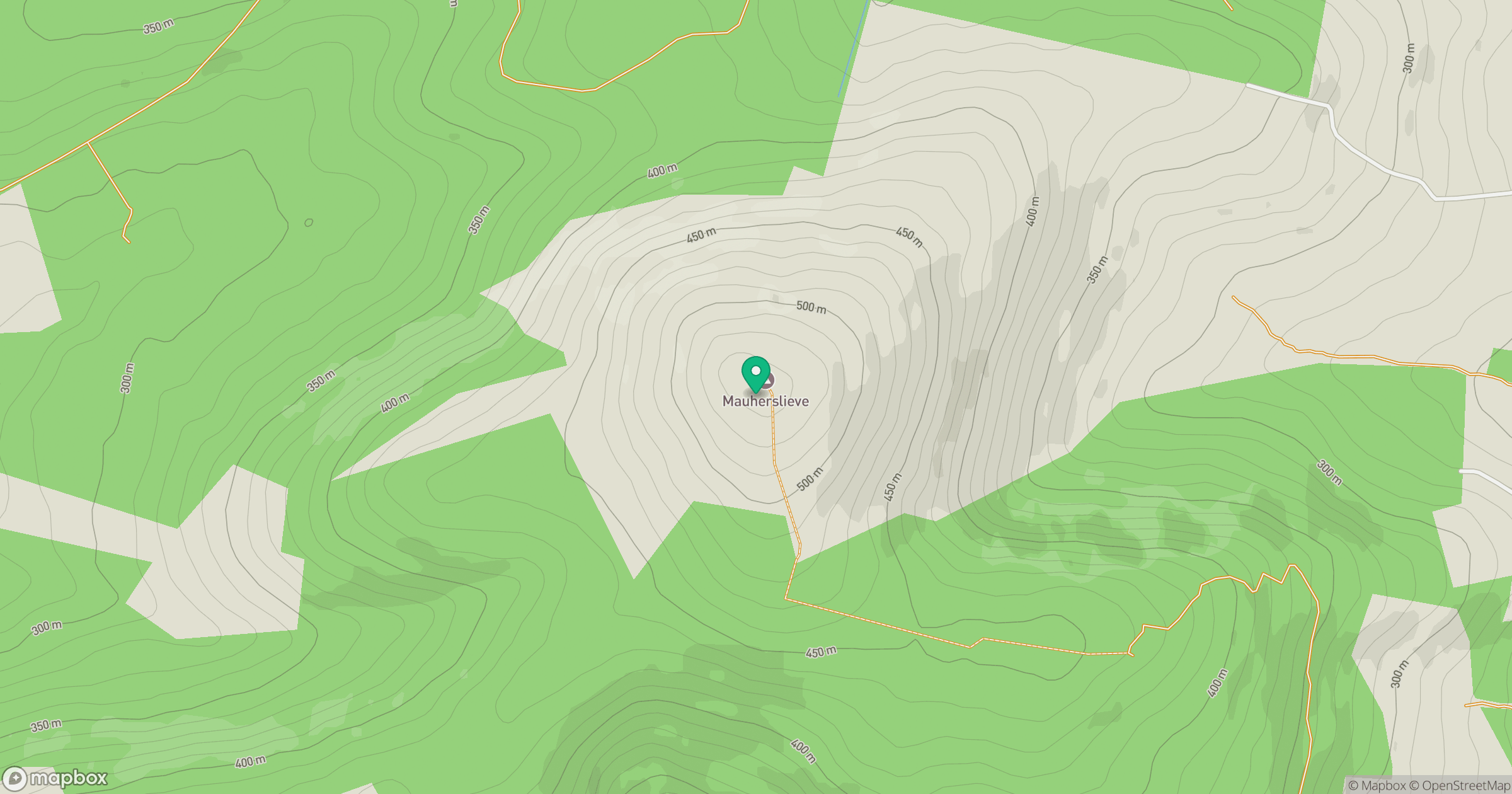
Grid reference: R873619
View on OpenStreetMapOpens a map in a new tab, centred on the hill.
Hills within 30 km
Straight-line distance, not a walking route or confirmation of access.
No comments yet. Be the first.